With the accreditation team visit scheduled for the week ending October 9, 2015, the information below might help to jog your memory if visiting team members ask about DE issues, including Regular Effective Contact and Accessibility:

Regular Effective Contact/Regular Substantive Interaction

  • Title 5 defines REC, and stresses the importance of “instructor initiated” contact with students in DE courses.
  • REC is the thing that distinguishes DE courses from correspondence courses. FLC does not offer correspondence courses.
  • REC is required in both hybrid and online courses. That is, the face-to-face time you spend with your students in a hybrid course does not count as “contact” for the purposes of REC, and you should also maintain contact with your students for the online parts of your course.
  • The college has a set of guidelines for online, hybrid and web-enhanced instruction: https://docs.google.com/document/d/1E2fpEQx5kY_lJ3EDf7OJaZv1F8qEjBc-DA7if-hjTzA/edit?usp=sharing
  • The district “audited” REC in online and hybrid courses last semester, using the metric of 1 contact per unit per week. For a 3 unit, 100% online course, this would be a minimum of 3 contacts per week. In most courses audited, the contact was evident. In some, contact occurred but was not visible to the auditors, and DO requested additional information from faculty teaching those courses.
  • REC can be accomplished in a variety of ways and using a variety of tools, including but not limited to email messages to students, responses to discussion postings, news items, and other forms of feedback.
  • The DE course checklist linked below might help you assess REC in your course: https://docs.google.com/document/d/1WdCY14pQ0w-eqlwFl6t4E8i3xEQk1oQ52Z8NIVR7mwk/edit?usp=sharing
  • @One offers a very much more in-depth rubric entitled “Standards for Quality Online Teaching” that you may find helpful: https://dl.dropboxusercontent.com/u/60279976/%40ONE_SQOT.pdf

Accessibility

  • While it isn’t perfect, D2L as a platform is considered generally accessible to students with disabilities.
  • The law states that all video files in your online and hybrid courses should be captioned.
  • The law states that you should provide a transcript for all audio files in your online and hybrid courses.
  • If you have content in your online or hybrid courses that doesn’t meet accessibility guidelines, it’s important to be aware of and work toward compliance.
  • For more information about captioning, you may wish to view this desktop seminar from @One: http://www.3cmediasolutions.org/node/17912
  • 3C Media Solutions has a grant-funded captioning service, and you can request captioning for videos that you upload: http://www.3cmediasolutions.org/sites/default/files/How%20to%20Request%20a%20DECT.pdf
  • The college will soon be hiring a .6 Education Media Design Specialist, a permanent position working out of the DSP&S office to assist with accessibility issues.

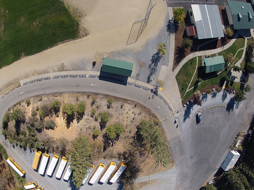
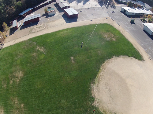
The weather is changing today, bringing cooler temperatures and, most importantly, steady wind. I took the KAP rig down to the local grade school, and after some fussing, was able to get it up in the air. At about 100′ feet the kite found a steady wind, so I attached the picavet to the line and sent it up.  The kite kept pulling like a champ, so I kept feeding it line until the line ran out.

Kite Aerial Photography - Georgetown School

After a few more practice runs, we’ll send the IR camera up, hopefully at Wakamatsu or over the wetlands below the college.

Bringing the KAP Rig Down

Untitled
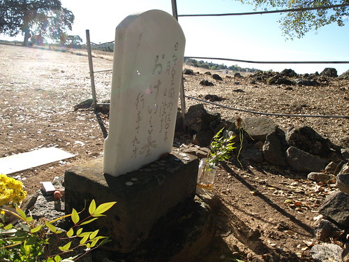
Spent the day Friday touring Wakamatsu Tea and Silk Colony Farm, an historic area above the American River in Gold Hill with one of co-conspirator Jason Pittman’s California Geography classes.  Visited the grave of Okei, the first recorded burial of a Japanese woman in the United States.

P1013164

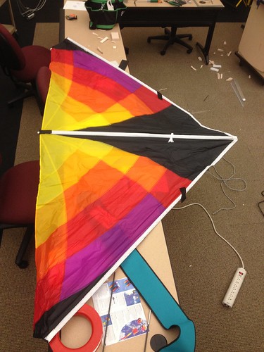
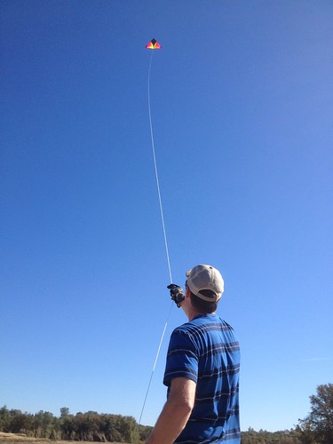
Jason and his students have done some work for the American River Conservancy in the past, GPSing trails and the like, and we’re working on a plan to do some aerial imaging in support of ARC’s Wakamatsu re-vegetation and de-vegetation efforts – yellow star thistle is a mean invasive weed, and it is everywhere on the Wakamatsu property (and throughout the county).  Following the tour, we assembled and practiced flying the delta. The anemometer was registering inconsistent winds at ground level in the 2-4 mph range, which was enough to get the kite up in the air a few times, but not enough to keep it there, nor to allow it to really lift the camera rig.

Untitled
Though we weren’t able to gather any images, we did learn a lot about flying the kite, rigging the picavet, and what to include in our KAP kit.  All in all a successful day.  Always be prototyping!

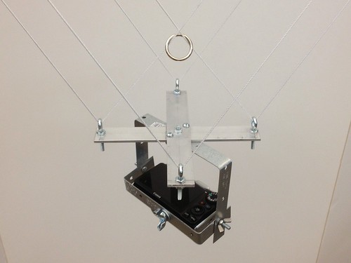
Modified the original design a bit, moving up to 2″ aluminum bar stock for the cross, to allow for the camera to hang on the same plane as the balloon string.

Untitled

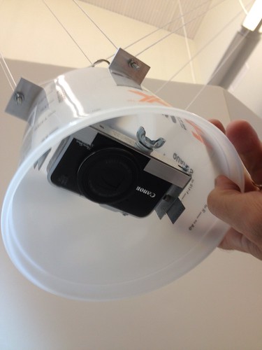
I also added a bucket, which I’ll foam up in an attempt to protect the camera in a bombs away scenario. 2 and a half quarts of security theater!

Update: I walked over to Printing Services and weighed the picavet rig with camera in place. 1 lb, 3.2 ounces. Given the helium shortage, we’re looking into kites as an alternative, and the rig weight will inform the kite selection process.

In preparation for some weather balloon flights, we’re working on building up a picavet, which will keep the camera level and steady regardless of the angle of the string – you can read all about them here:  http://www.kaper.us/basics/BASICS_picavet.html

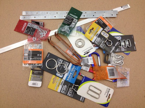
After a couple of hours at the local hardware store, I ended up with a big pile of little parts.

Picavet Parts

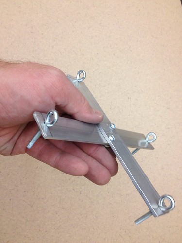
I set to work this morning, and was able to knock out the basic framework for the part that attaches to the kite/balloon string:

Basic Picavet Frame

Lots of guidance on the web – I drew inspiration from http://www.arch.ced.berkeley.edu/kap/equip/picavet.html#no3.

Next is the camera mount, which attaches to the suspension frame pictured above.  We hope to test it out next week, and to tweak and adapt in advance of a project that will see students doing some aerial and ground surveying of a local nature area.