Jason Pittman (Geosciences), Max Mahoney (Chemistry) and I took the new quadcopter out to Lava Cap Winery to do a test flight.

Flying

Dronedeploy (the system we use for flight planning and analysis) offers some interesting post-flight map creation and analysis. Here are the Plant Health and Elevation views.

Plant Health and Elevation

We were stoked to see the Model view for the first time.
Model

We’re still figuring out what it all means, but we’re excited about the preliminary results!

Whenever we do a flight day, we try and have at least one student taking photos and documenting the process.  Here are some Folsom Lake College students at our most recent BAP field day doing science – taking GPS coordinates, shooting the balloon with the laser rangefinder, and logging data.

Doing Science - GPS

Doing Science - Range Finding

Science - Data Logging

FLC's Garden From Above

Field day with Jason Pittman’s (Geosciences) mapping class yesterday. We flew the 3D printed picavet for the first time. After we worked the wetlands, two student volunteers agreed to walk the balloon up into campus, as I wanted to get shots of the garden. That little patch of green in the dry area (above) is the garden. Image below from a different flight for comparison.

FLC's Garden as Seen from Above

The entire dataset can be found at the project blog (DoLookDown.org), as well as the images from our 2014 and 2015 flights of the same area.  When I find the time, I plan to redesign and 3D print the picavet from the ground up, shaving some additional weight.

FLC's Garden as Seen from Above

Following a successful field day with students, the balloon had enough spirit to pull the iPhone up over the site of FLC’s new experimental garden.  It may not look like much now, but there are plans for additional planter boxes, shrubs, and all sorts of growing goodness.

Gearing up for a field day
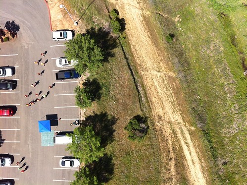
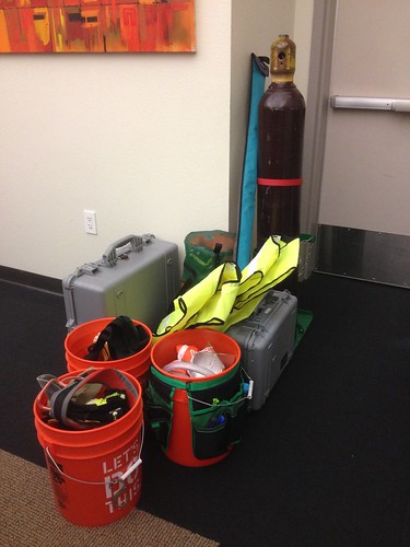
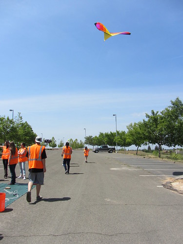
Kite? Check. Helium? Check. It takes quite a bit of gear to execute a proper field day. Professor Jason Pittman arranged a KAP/BAP field day, and we headed up to the wetlands on the north end of campus to meet students around noon. Following a brief safety talk and protocol orientation, one team set out to launch the balloon, while the other team assembled and attempted to launch the kite.

Filling balloon Number 1
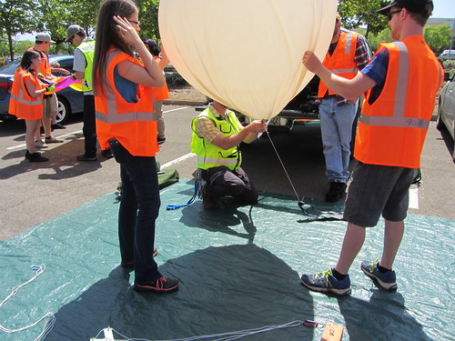
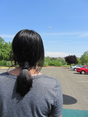
Half-full, balloon #1 revealed some pinhole leaks, so we tried to move the gas to a second balloon, which didn’t work at all, and we popped the first one in the process. Fortunately, we were able to get one of the spares filled and in the air.

IMG_0273
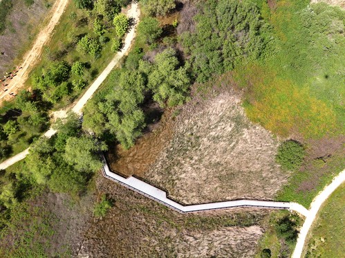
The kite team struggled with inconsistent wind. After many heroic attempts, they eventually scrapped the launch and joined the balloon team to walk the wetlands.

IMG_0267
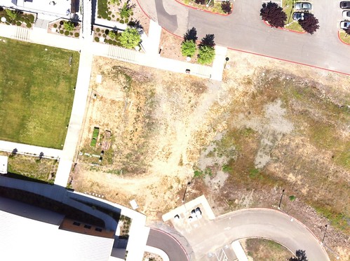
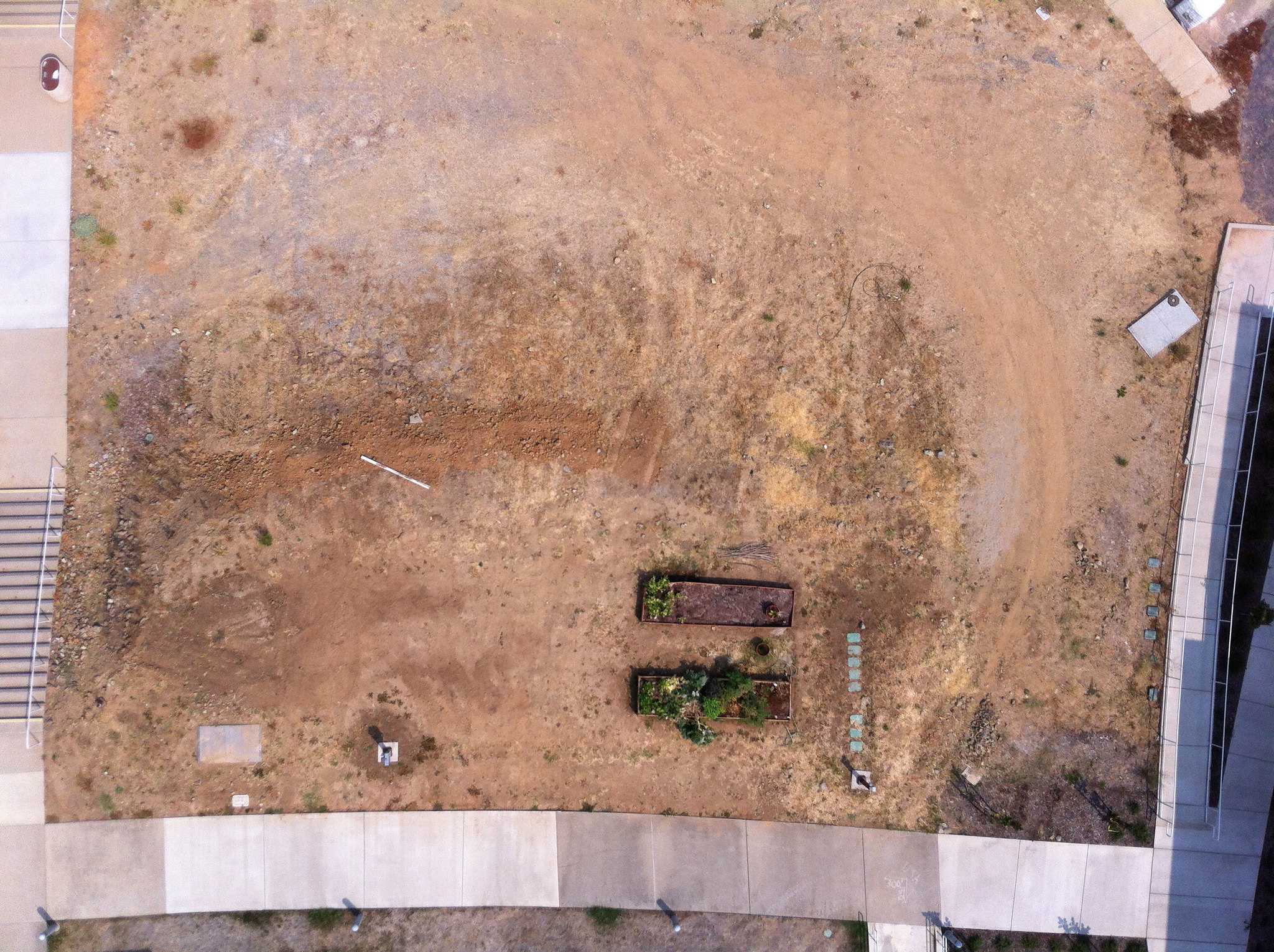
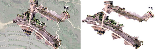
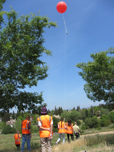
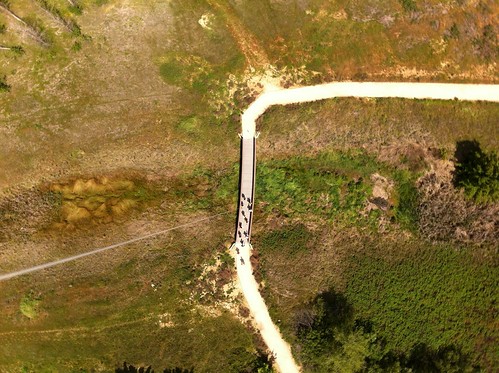
We flew for ~40 minutes, with the camera (iPhone on the picavet, running Timelapse at 10 second intervals), and captured some really good shots.  (Link:  The full set images from 04.24.15 BAP field day.)

BAP!
At 2 o’clock, we headed back to the cars to stow the gear and head out. A few students hung around and had a chance to fly our newest quad.

IMG_0281
All things considered, a successful field day.

iPhone/GoPro Mount Mashup
We’ve had some success using the iPhone for aerial imaging from kites, balloons, and quads, so I’ve been looking for a way to mount one to our new Phantom’s GoPro mounting base plate. A quick search of http://thingiverse.com returned this GoPro-compatible iPhone case created by N3W0NE (CC BY-NC-SA). I printed it out on our new Printrbot, and while it technically fits, it needs a little adjustment to be ideal for our situation.  Most GoPro and iPhone users want to mount cameras facing forward, but ours needs to be pointing straight down, which sometimes doesn’t quite work – various mounts and housings get in the way.  For this model to work correctly for our needs, it needs to be tweaked so that the GoPro mount bit is on the short edge of the iPhone.  Not a big deal, and I’m grateful that communities like Thingiverse exist, and that folks are willing to share their work.

thingiverse_contact_card


The new quadcopter arrived, and it flies like a dream right out of the box.  We’ve been looking for a stable, predictable (some would say boring) flyer, and this machine seems to fit the bill.  Excited to put it through its paces in the next few weeks!

Thanks to the very responsive team at Publiclab.org – Stewart, Jeff and Liz! –  MapKnitter is back up and running exports.  Here’s a before and after version of one student’s work with the balloon photos:

Before and After
Overall, a fine result, but a few anomalies might bear some experimentation.  For instance, the dropouts toward the top of the north/south path on the left-hand side, and a small faded out area near the bottom left, just above where the east/west and north/south paths join.  If I had to guess, I’d say these were the result of too many overlapping images in those particular sections.  I think I’ll see about thinning out some of the overlaps to see if I can’t get a cleaner export.