Got our new DJI Inspire 2 up in the air for the first time today!

2019-06-14_05-05-36

Using DroneDeploy for mission planning is surprisingly easy, and the quad is easy to control, with auto takeoff and auto landing.

The technology has come a long way since we built and flew our first quad back in 2012. We plan to use this one to continue to support remote sensing in the Geosciences, and to fly vineyards as part of our FermSci and viticulture efforts.

Thanks to the very responsive team at Publiclab.org – Stewart, Jeff and Liz! –  MapKnitter is back up and running exports.  Here’s a before and after version of one student’s work with the balloon photos:

Before and After
Overall, a fine result, but a few anomalies might bear some experimentation.  For instance, the dropouts toward the top of the north/south path on the left-hand side, and a small faded out area near the bottom left, just above where the east/west and north/south paths join.  If I had to guess, I’d say these were the result of too many overlapping images in those particular sections.  I think I’ll see about thinning out some of the overlaps to see if I can’t get a cleaner export.

Untitled
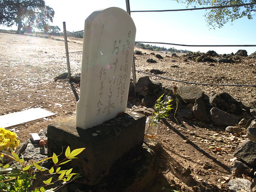
Spent the day Friday touring Wakamatsu Tea and Silk Colony Farm, an historic area above the American River in Gold Hill with one of co-conspirator Jason Pittman’s California Geography classes.  Visited the grave of Okei, the first recorded burial of a Japanese woman in the United States.

P1013164

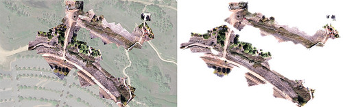
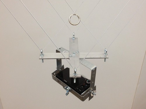
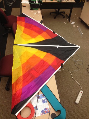
Jason and his students have done some work for the American River Conservancy in the past, GPSing trails and the like, and we’re working on a plan to do some aerial imaging in support of ARC’s Wakamatsu re-vegetation and de-vegetation efforts – yellow star thistle is a mean invasive weed, and it is everywhere on the Wakamatsu property (and throughout the county).  Following the tour, we assembled and practiced flying the delta. The anemometer was registering inconsistent winds at ground level in the 2-4 mph range, which was enough to get the kite up in the air a few times, but not enough to keep it there, nor to allow it to really lift the camera rig.

Untitled
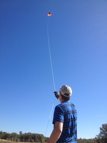
Though we weren’t able to gather any images, we did learn a lot about flying the kite, rigging the picavet, and what to include in our KAP kit.  All in all a successful day.  Always be prototyping!

Photo CC BY-NC-SA from http://openrov.com

This little beauty is the OpenROV.  From the site:

OpenROV is a
 Do It Yourself telerobotics community centered around underwater exploration and education. We have developed a low-cost telerobotic submarine that can be built with mostly off-the-shelf parts.
The goal of OpenROV is to democratize exploration by allowing anyone to explore and study underwater environments.

I spent a few minutes in conversation with the creators this afternoon after they spoke at Maker Faire.  Since the start of the quadcopter project, I’ve been talking to Jason Pittman (Professor, Geosciences) about expanding our remote sensing capabilities, and bathymetry is part of that discussion.  The OpenROV folks seemed very open to and interested in partnering with educational institutions, so I’m looking forward to checking out their platform and finding out how we might be able to work together.